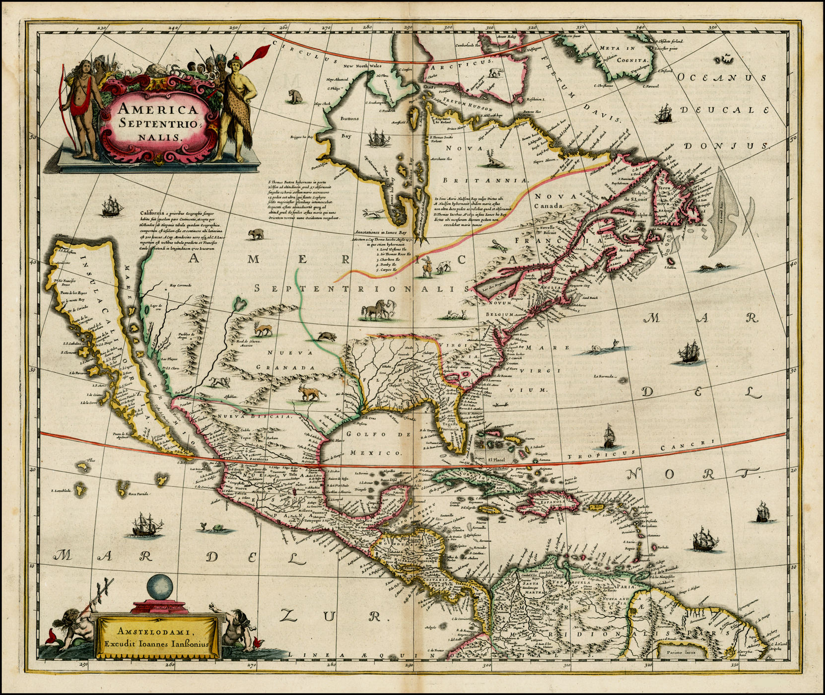
Jan Jansson: America Septentrionalis
Jan Jansson
1641
Hand Colored
Size: 22 x 18.5 inches
Nice old color example of Jansson's map of North America, called by Burden the single most influential map in perpetuating the myth of California as an Island.
The map is a well-researched amalgam of the best cartographic resources available. In the West. Jannson draws heavily upon Briggs 1625 map of North America. An unnamed lake still feeds the Rio de Norto (Rio Grande), which is incorrectly shown flowing southwest into the Sea of Cortez. The Gulf of Mexico and Florida are based upon Hessel Gerritsz’s map of 1631. The east coast draws from a number of sources. Jamestown is shown. Novum Belgium is unlike prior maps between the Delaware and Hudson, being greatly elongated. New Amsterdam is not shown, but Ft. Orange is located. The place names in New England are based upon John Smith's map of 1616. The Gulf of St. Lawrence appears to follow De Laet. The map is richly illustrated with ships, sea monsters and animals in the interior parts of North America.
An essential map for collectors of North America and California, being the first atlas map to show North America only, the first widely disseminated map of California as an island and a host of other important features. Second state per Burden, with Latin text on verso.
Very faint discoloration at centerfold, else a very nice example, in full orginal color.
No comments:
Post a Comment