Thursday, 21 July 2011

The Art of Maps: Nova et Accuratissima Totius Terrarum Orbis Tabula Auctore Joanne Blaeu


Nova et Accuratissima Totius Terrarum Orbis Tabula Auctore Joanne Blaeu


Map Maker: Willem Janszoon Blaeu

Place / Date: Amsterdam / 1662

Coloring: Hand Colored

Size: 21.5 x 16 inches

Price: $22,500.00


Nice old color example of Blaeu's double hemisphere map of the World, originally prepared by Joan Blaeu for his Atlas Maior in 1662. The map was also included in contemporary composite sea atlases of the period by Goos and others.

Unlike Blaeu's first world map which appeared in the majority of his atlases and was done on the Mercator projection, Blaeu utilizes a double hemisphere format and depicts California as an island.

This double hemisphere map was prepared at the end of the firm's publishing history and is much rarer than its predecessor. The engraving, layout and elegance of decoration are all of the highest standard. The map depicts celestial figures seated among the clouds and representations of the four season below, with each figure seated in a chariot drawn by beasts and birds. Because of the relatively scarity of this map and Blaeu's prominence as one of the most influential and decorative map makers of the Golden Age of Dutch Cartography, this map has become especially sought after by collectors and increasingly scarce on the market.


Condition Description: Old color. Split and tear in upper margin, entering image, but well repaired on verso. Minor tear in lower left margin, just entering printed image. Some minor soiling in the image and in the blank margins.

Monday, 11 July 2011

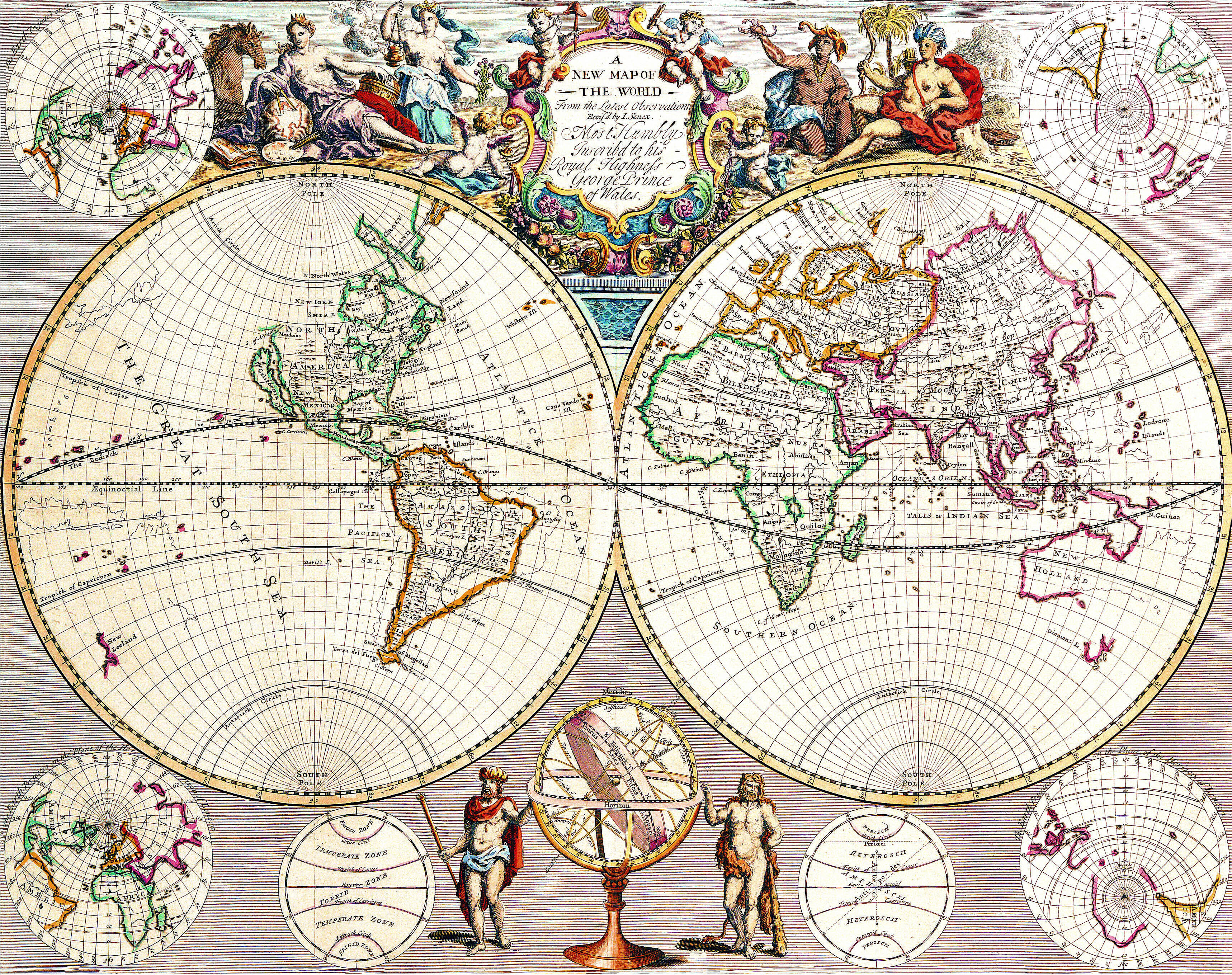
The Art of Maps: New Map of The World From The Latest Observations

A New Map of The World From The Latest Observations…Most Humbly Inscribed to his Royal Highness George Prince of Wales


A New Map of The World From The Latest Observations…Most Humbly Inscribed to his Royal Highness George Prince of Wales

Map Maker: John Senex

Price: $3,600.00

Size: 21.5 x 16.5 inches

Place / Date: London / 1721

Condition: VG

Coloring: Hand Colored

Description:

Striking double hemisphere map of the World, from John Senex's New General Atlas, first published in 1721.

Senex's map provides a fine look at a number of the surviving myths and cartographic inaccuracies of the early 18th Century. California is shown as an Island, both New Zealand and Australia have incomplete coastlines, there is no sign of Antarctica, New Guinea is still shown as connected to Australia, and the Northwest Coast of America ends near the present day Straits of Juan de Fuca, with a speculative remnant of the old land bridge between Asia and America shown, but without meaningful detail.

The map includes 4 smaller Northern and Southern Hemisphere projections, an armillary and other scientific drawings.  A fine allegorical vignette across the top shows the four continents as womena, with Europe, the scholar, studying the globe, Asia, the exotic trading partner, with an urn of incense, while the primitive Africa and America appear on the far side of the title cartouche.


Share this: