Friday, 3 February 2012

The Art of Maps: Map of Gallia From Mercator


Atlas sive Cosmographicae by Gerardus Mercator (1595)

The Fleming Gerard Mercator (1512-1594) is rightfully regarded as the most important scientific cartographer of the Renaissance. With two contemporaries, the geographer Abraham Ortelius and the printer and publisher Christoffel Plantijn,he is considered the father of commercial cartography in the Netherlands.Even during his lifetime his maps, globes and atlases found their way all over the world.Mercator established his reputation mainly through his new projection method. The meridians and parallels are positioned at right angles to each other.If the distances between the meridians are equal, they progressively become larger between the parallels from the equator to the poles.This is why the latitude becomes wider the closer you get to one of the poles and why the part of the Earth in the upper latitudes exhibits excessive proportions.The advantage of this method was the far greater degree of certainty and accuracy in determining shipping routes.In 1585, Mercator published the first three parts of his own book of maps in one volume,which he called Atlas.The second edition appeared in 1589, with the addition of a fourth part. The first complete edition was compiled by his heirs in 1595 one year after his death.Walter Ghim,mayor of Duisburg the city where Mercator had lived for a long time,wrote the accompanying Mercator biography.It was the first time that a book of maps was referred to as an Atlas.Commercially speaking,however,the Atlas was not a success thanks to formidable competition from the Theatrum orbis terrarum by Abraham Ortelius,published in 1570,which by the end of the century had been reprinted more than twenty times.


The Art Of Maps:

Tuesday, 10 January 2012

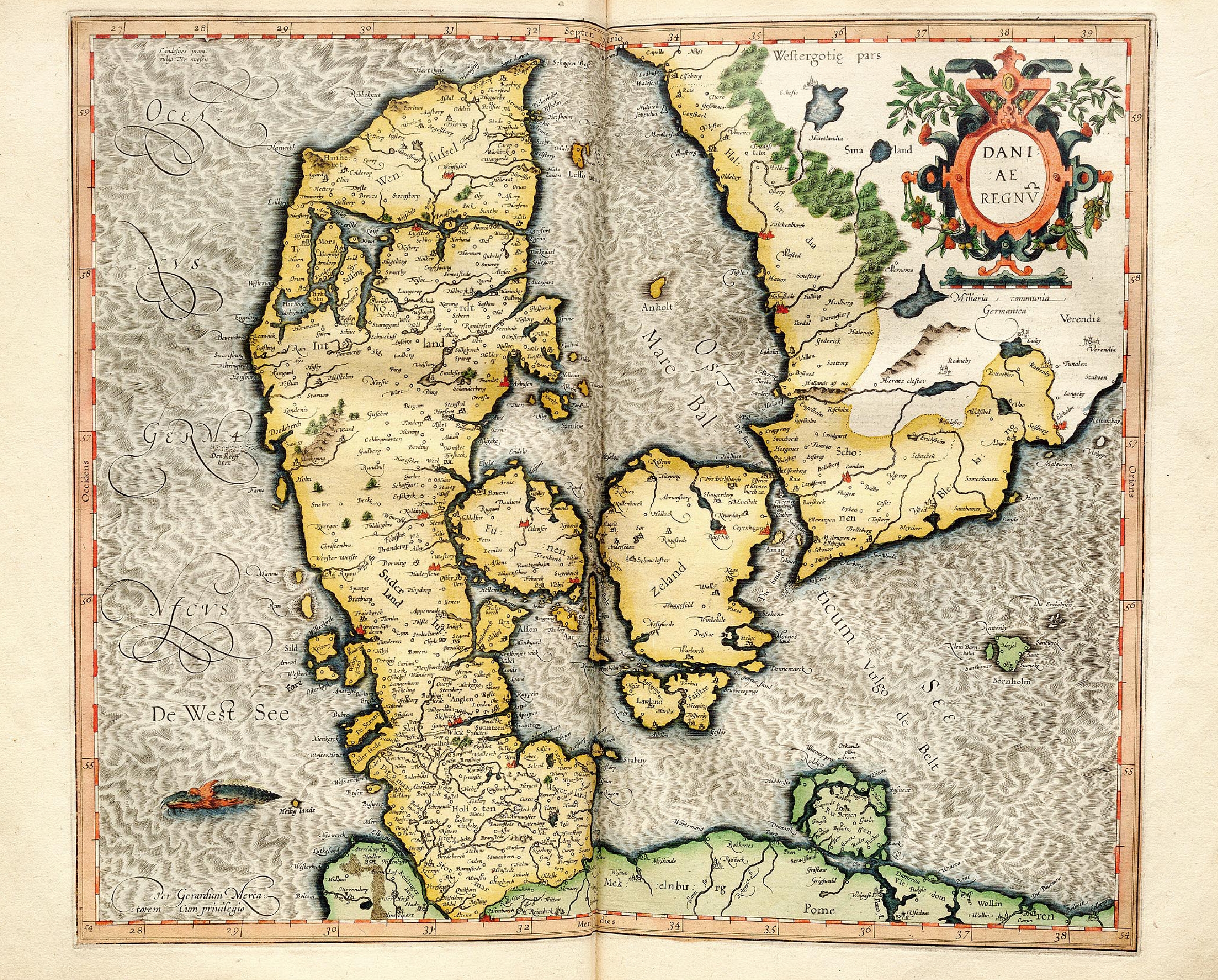
The Art Of Maps: Map of Daniae Regnv From Mercator


Atlas sive Cosmographicae by Gerardus Mercator (1595)

The Fleming Gerard Mercator (1512-1594) is rightfully regarded as the most important scientific cartographer of the Renaissance. With two contemporaries, the geographer Abraham Ortelius and the printer and publisher Christoffel Plantijn,he is considered the father of commercial cartography in the Netherlands.Even during his lifetime his maps, globes and atlases found their way all over the world.Mercator established his reputation mainly through his new projection method. The meridians and parallels are positioned at right angles to each other.If the distances between the meridians are equal, they progressively become larger between the parallels from the equator to the poles.This is why the latitude becomes wider the closer you get to one of the poles and why the part of the Earth in the upper latitudes exhibits excessive proportions.The advantage of this method was the far greater degree of certainty and accuracy in determining shipping routes.In 1585, Mercator published the first three parts of his own book of maps in one volume,which he called Atlas.The second edition appeared in 1589, with the addition of a fourth part. The first complete edition was compiled by his heirs in 1595 one year after his death.Walter Ghim,mayor of Duisburg the city where Mercator had lived for a long time,wrote the accompanying Mercator biography.It was the first time that a book of maps was referred to as an Atlas.Commercially speaking,however,the Atlas was not a success thanks to formidable competition from the Theatrum orbis terrarum by Abraham Ortelius,published in 1570,which by the end of the century had been reprinted more than twenty times.


The Art Of Maps:

Thursday, 15 December 2011

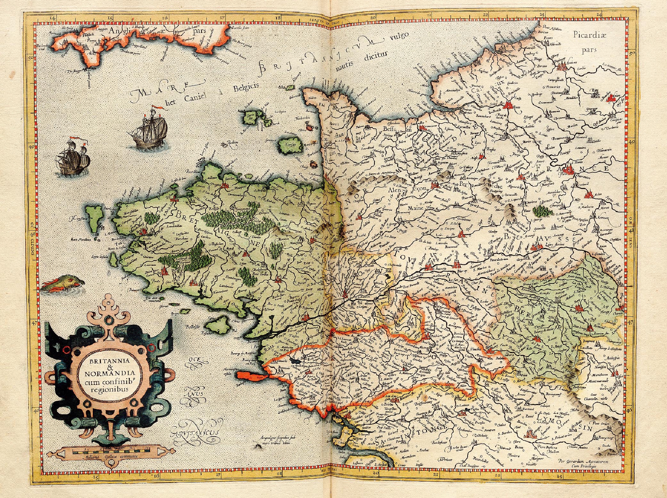
The Art of Maps: Britannia & Normandia From Mercator


Atlas sive Cosmographicae by Gerardus Mercator (1595)

The Fleming Gerard Mercator (1512-1594) is rightfully regarded as the most important scientific cartographer of the Renaissance. With two contemporaries, the geographer Abraham Ortelius and the printer and publisher Christoffel Plantijn,he is considered the father of commercial cartography in the Netherlands.Even during his lifetime his maps, globes and atlases found their way all over the world.Mercator established his reputation mainly through his new projection method. The meridians and parallels are positioned at right angles to each other.If the distances between the meridians are equal, they progressively become larger between the parallels from the equator to the poles.This is why the latitude becomes wider the closer you get to one of the poles and why the part of the Earth in the upper latitudes exhibits excessive proportions.The advantage of this method was the far greater degree of certainty and accuracy in determining shipping routes.In 1585, Mercator published the first three parts of his own book of maps in one volume,which he called Atlas.The second edition appeared in 1589, with the addition of a fourth part. The first complete edition was compiled by his heirs in 1595 one year after his death.Walter Ghim,mayor of Duisburg the city where Mercator had lived for a long time,wrote the accompanying Mercator biography.It was the first time that a book of maps was referred to as an Atlas.Commercially speaking,however,the Atlas was not a success thanks to formidable competition from the Theatrum orbis terrarum by Abraham Ortelius,published in 1570,which by the end of the century had been reprinted more than twenty times.


The Art Of Maps:

Wednesday, 2 November 2011

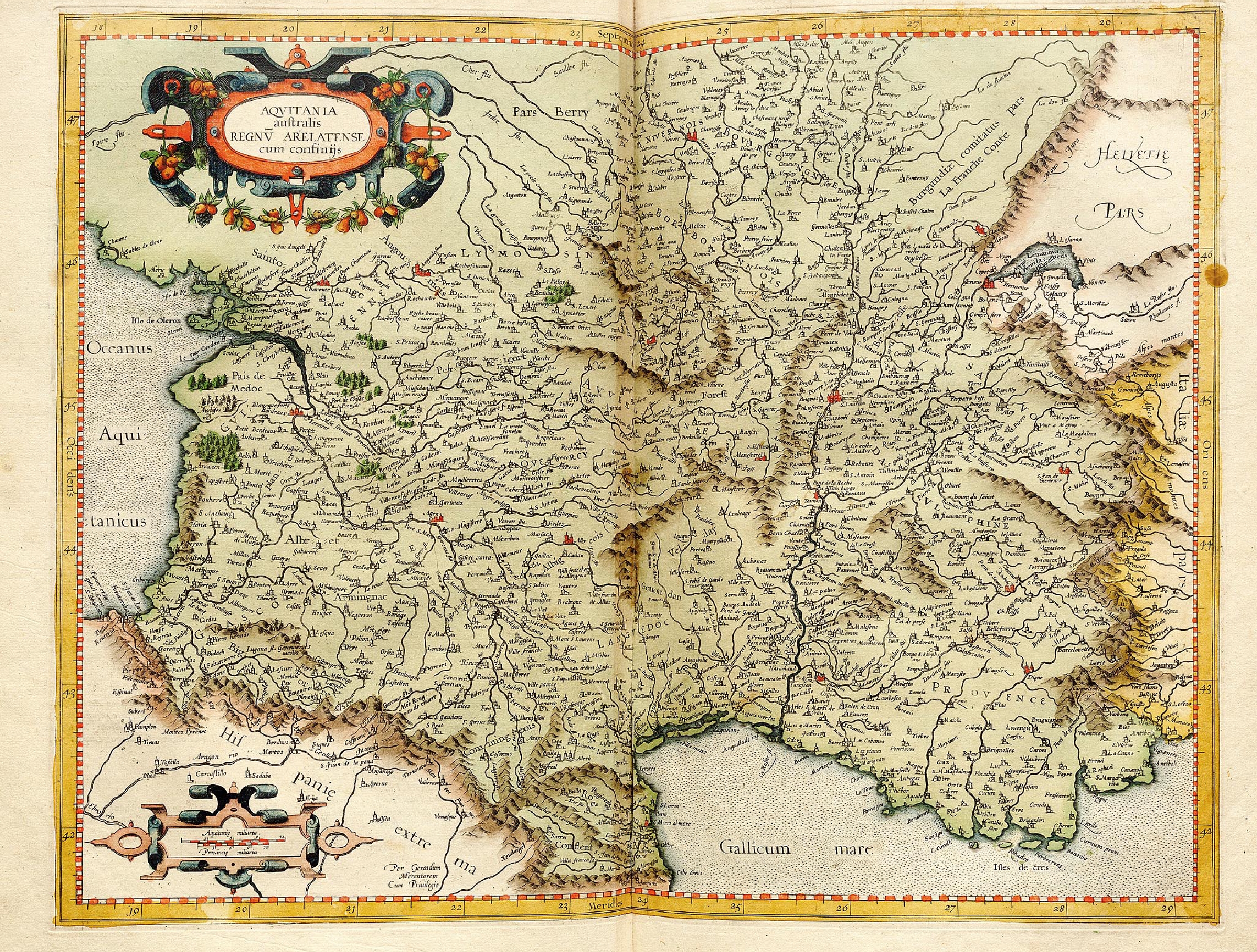
The Art of Maps: Map of Aqvitania From Mercator.jpg


Atlas sive Cosmographicae by Gerardus Mercator (1595)

The Fleming Gerard Mercator (1512-1594) is rightfully regarded as the most important scientific cartographer of the Renaissance. With two contemporaries, the geographer Abraham Ortelius and the printer and publisher Christoffel Plantijn,he is considered the father of commercial cartography in the Netherlands.Even during his lifetime his maps, globes and atlases found their way all over the world.Mercator established his reputation mainly through his new projection method. The meridians and parallels are positioned at right angles to each other.If the distances between the meridians are equal, they progressively become larger between the parallels from the equator to the poles.This is why the latitude becomes wider the closer you get to one of the poles and why the part of the Earth in the upper latitudes exhibits excessive proportions.The advantage of this method was the far greater degree of certainty and accuracy in determining shipping routes.In 1585, Mercator published the first three parts of his own book of maps in one volume,which he called Atlas.The second edition appeared in 1589, with the addition of a fourth part. The first complete edition was compiled by his heirs in 1595 one year after his death.Walter Ghim,mayor of Duisburg the city where Mercator had lived for a long time,wrote the accompanying Mercator biography.It was the first time that a book of maps was referred to as an Atlas.Commercially speaking,however,the Atlas was not a success thanks to formidable competition from the Theatrum orbis terrarum by Abraham Ortelius,published in 1570,which by the end of the century had been reprinted more than twenty times.


The Art Of Maps:

Thursday, 27 October 2011

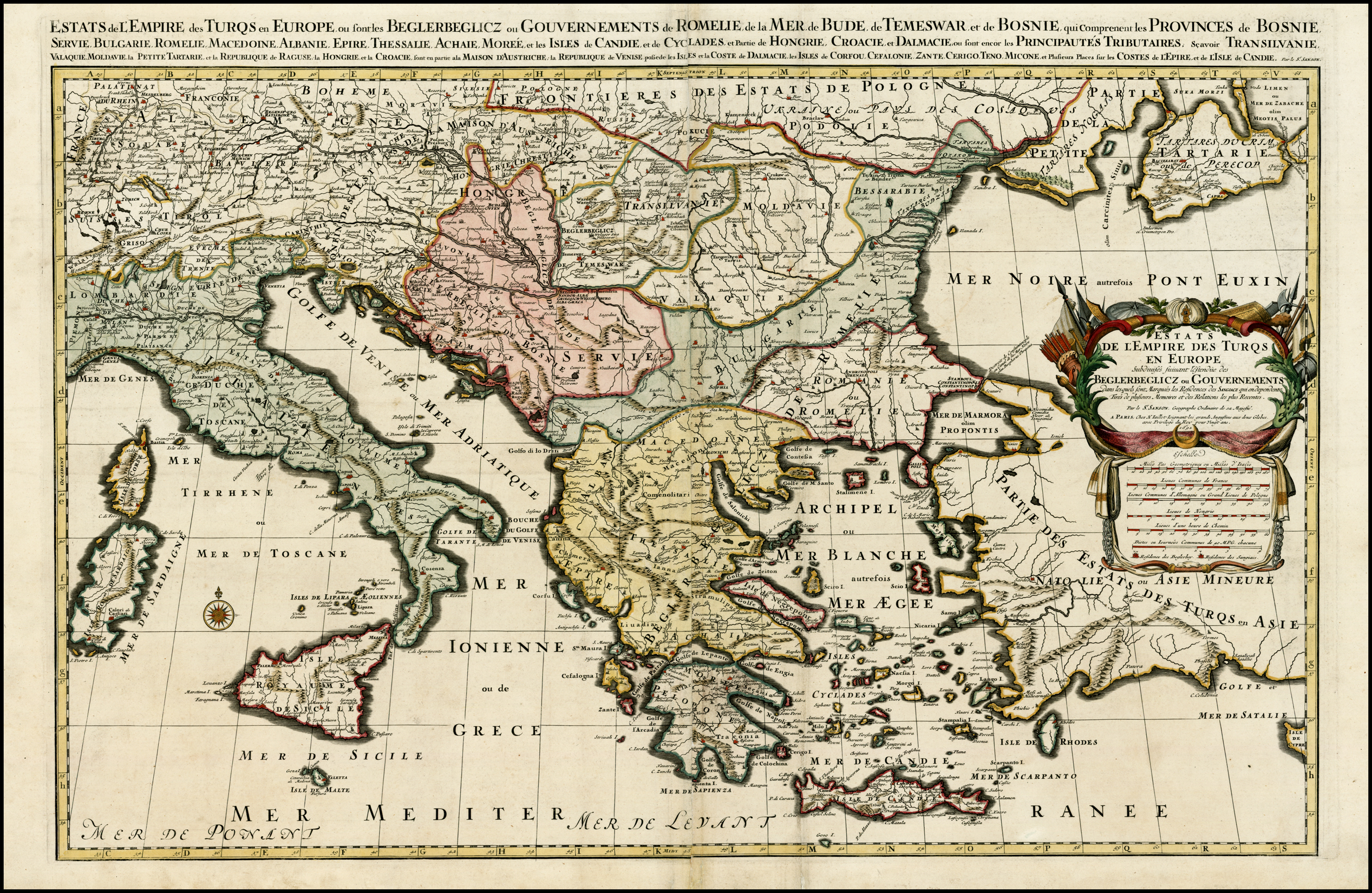
The Art of Maps: Hubert Jaillot Estats de L'Empire des Turqs en Europe, ou sont les Beglerbeglicz our Gouvernements 1692


Hubert Jaillot:  Estats de L'Empire des Turqs en Europe, ou sont les Beglerbeglicz our Gouvernements


Estats de L'Empire des Turqs en Europe, ou sont les Beglerbeglicz our Gouvernements . . .
Hubert Jaillot
Amsterdam / 1692
Hand Colored


Size: 34 x 22 inches


Scarce large format map of the Turkish Empire in Europe and the Eastern Mediterranean, published by Jaillot, based upon the earlier maps of Nicolas Sanson.

Thursday, 20 October 2011

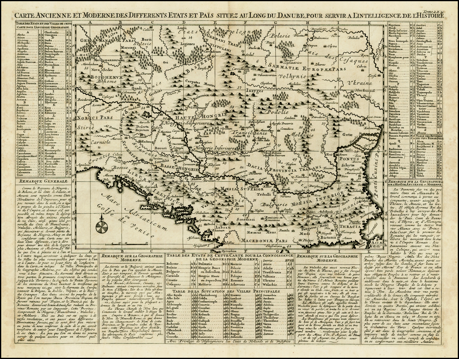
The Art of Maps: Henri Chatelain Carte Ancienne et Moderne des Differents Etats et Pais situez au Long du Danube pour servir a L'Intelligence De L'Histoire


Henri Chatelain:  Carte Ancienne et Moderne des Differents Etats et Pais situez au Long du Danube, pour servir a L'Intelligence De L'Histoire


Carte Ancienne et Moderne des Differents Etats et Pais situez au Long du Danube, pour servir a L'Intelligence De L'Histoire


Henri Chatelain


Amsterdam / 1719


Uncolored


Size: 18 x 14 inches


Detailed map of the region north of the Adriatic Sea and centered on the Danube River, from Croatia to the Black Sea.


Surrounded by descriptive French text.

Wednesday, 12 October 2011

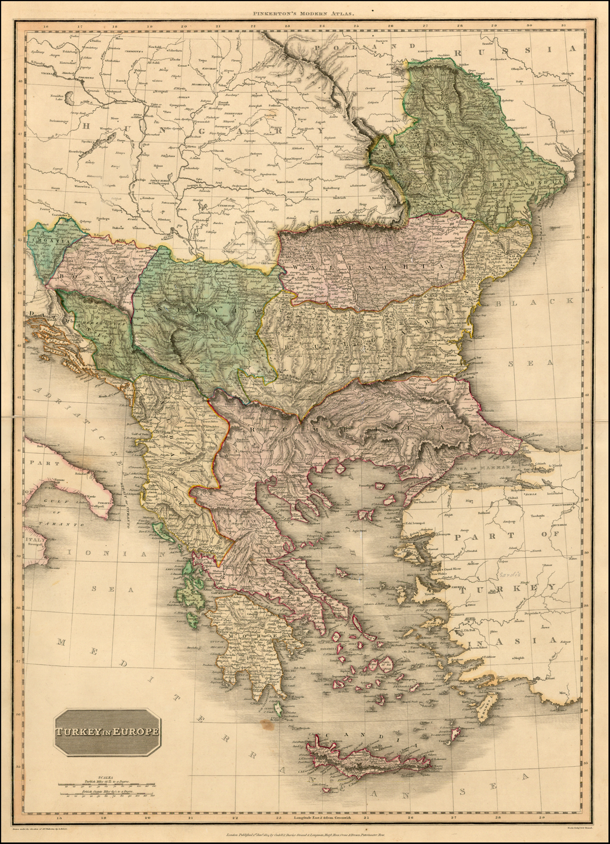
The Art of Maps: John Pinkerton Turkey In Europe


John Pinkerton:  Turkey In Europe


Turkey In Europe
John Pinkerton
London / 1812
Hand Colored


Size: 28 x 20 inches


An excellent detailed regional map of Bulgaria, Turkey and Greece, showing towns, roads, rivers, mountains, lakes, and other items of interest. Handcolored by regions.


Condition Description: One minor spot

Share this: